Basic Principles
Basic Principles
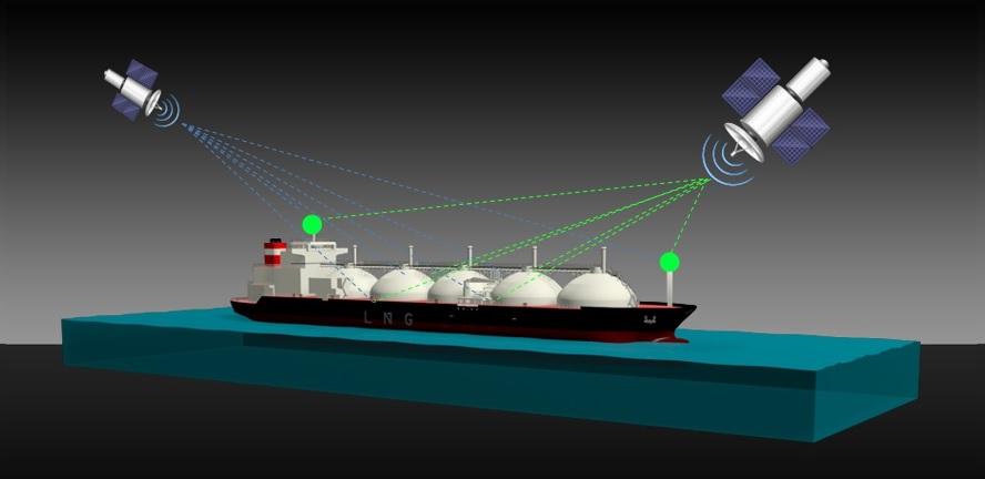
The Ships Movement Information Display System (SMIDS) comprises of two satellite positioning system (GPS and GLONASS) receivers fixed on the bow and stern of the vessel. The receiver information is electronically integrated with the gyroscopic heading data. The rate of change of the receiver’s position is calculated and the information is processed to give the vessel real-time fore/aft, port/starboard and bow/stern movement over the earth’s surface. The data is translated into positional, directional and velocity information. It is then presented in a standard format normally seen on traditional docking displays.
SMIDS does not use raw GPS/GLONASS satellite derived velocity data. Real-time data is received continuously from the two satellite constellations. Standard GPS and differential signals can also be used.? A combination of signal averaging and software programming enables a visual representation of the ship velocity and direction to be displayed. True and relative motion is also calculated.
Both receivers process positional fixes simultaneously from the same “over the horizon” satellites. Real-time data is produced which in turn generates the system accuracies. using both GLONASS and GPS and combining the two systems enables inaccuracies to be groomed out.
One very useful facility is the SMIDS generated secondary heading reference unit, which can be used as a gyroscope backup. Heading is determined from the bow and stern positional errors, which have a tendency to be more or less identical. Because the same satellites are being received on the two antennas they are, in effect, acting differentially which enables the vessel position in azimuth to be calculated accurately. The latitude and longitude information complete with the positional data can be utilised to support integrated bridges systems.
The continuous SMIDS data streams can provide rapid stabilised inputs to Electronic Chart Display information System (ECDIS), Voyage Data Recorder (VDR) and radar overlay displays. This data can also be available for Automatic Radar Plotting Aid (ARPA) and Global Maritime Distress and Safety System (GMDSS) equipment. Log speed information, either in the form of 200 pulse contact closures or as National Maritime Electronics Association (NMEA) data, can also be transmitted. As the system is reliant on the distribution of data, in build diagnostic circuitry monitors all the input/output data and alerts the user if it detects a transmission problem. This is especially useful in the event of sudden navigation equipment failure. High reliability and easy access troubleshooting is a major of the SMIDS technology.